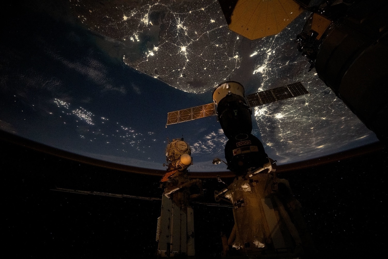
You’ve probably seen the viral photos of India from the International Space Station (ISS) by now. Golden webs of light stretching across the Indo-Gangetic plain, the dark void of the Himalayan wall, and the shimmering coastlines of the Arabian Sea. They’re stunning. But most people look at these images, hit the like button, and move on without actually seeing what’s happening on the ground.
These photos aren't just wallpaper material. They're a data-rich map of human migration, economic shifts, and the literal energy of over a billion people. When the ISS orbits roughly 250 miles above Earth, traveling at a staggering 17,500 miles per hour, it captures a version of India that you can't find on a standard GPS map.
The Science Behind the Glow
Those brilliant orange and white veins of light aren't just "electricity." They're a footprint. If you look closely at the recent captures over Northern India, you'll notice the distinct density of the Punjab and Haryana regions. The light there is almost continuous. This isn't just urbanization; it's a testament to the specific way Indian infrastructure has developed along historical trade routes.
NASA uses specialized cameras like the NightPod to compensate for the station's high speed. Without this tech, every photo would be a blurry mess. The NightPod tracks the Earth's movement, allowing for long-exposure shots that pull in enough light to show individual streetlamps in New Delhi or the concentrated industrial flares in Gujarat.
The color of the light tells a story too. Older high-pressure sodium lamps give off that classic orange glow. As cities like Bengaluru or Hyderabad modernize, you start seeing more "cool" white dots. That's the shift to LED. It’s a real-time visual of a nation upgrading its grid.
Why the Himalayas Look Like a Black Hole
One of the most striking parts of the recent ISS pass is the sudden, jagged end to the light in the north. One moment you have the hyper-bright sprawl of the NCR (National Capital Region), and the next, there’s a wall of absolute darkness.
That’s the Himalayas.
From space, the mountain range looks like a void. It’s one of the few places on the planet where human expansion just stops. You can see the lights of Shimla or Dehradun huddled at the base, but beyond that, the topography wins. Scientists use these "dark zones" to measure light pollution and its impact on local ecosystems. When we see the contrast between the Arabian Sea's dark expanse and the glowing Mumbai coastline, we're looking at the hard limits of where humans can comfortably live and build.
Beyond the Aesthetic
Let's get real about why these images matter for more than just Instagram. Organizations like the Indian Space Research Organisation (ISRO) and NASA often collaborate or share data to track "nighttime lights" (NTL) as a proxy for economic growth.
Standard GDP numbers can be fudged or delayed. Light doesn't lie. If a region’s light intensity grows by 10% over a year, it’s a direct indicator of increased economic activity, new housing, and better infrastructure. Conversely, when we see dimming in certain areas, it alerts researchers to power grid failures or economic downturns before the official reports even hit the desk.
The Technical Challenge of Orbiting India
Capturing India from the ISS isn't as simple as pointing a camera out the window. The station's path is predictable but its "viewing window" for specific landmarks is tiny. An astronaut has only seconds to frame a shot of the Kerala coast before the station zips toward Southeast Asia.
Atmospheric conditions are another hurdle. During certain months, heavy smog or monsoon clouds completely obscure the subcontinent. The recent "clear" shots shared by NASA are rare. They require a perfect alignment of a clear night, the ISS being in the right part of its orbital plane, and an astronaut being off-duty or ready at the window.
What You Should Look for Next Time
Next time a new set of "India from space" photos drops, don't just look at the bright spots. Look at the patterns.
- The Golden Quadrilateral: You can literally see the highway system connecting Delhi, Mumbai, Chennai, and Kolkata. The lights follow the roads.
- The Fishing Fleets: Look at the Arabian Sea. Those tiny green or white dots away from the coast? Those aren't islands. They're massive fishing fleets using high-intensity lights to attract squid and fish.
- The Rural-Urban Divide: Notice the vast "speckled" areas between the big hubs. That’s rural India, and the density of those specks is increasing every year.
If you want to track this yourself, you don't need to be an astronaut. You can use NASA’s "Worldview" tool or the "Nighttime Lights" dataset from the Earth Observation Group. It’s public info. You can zoom in on your own city and see how the light signature has changed over the last decade.
The ISS is a laboratory, but for a few minutes every day, it’s also the best seat in the house for watching a country of 1.4 billion people grow in real-time. Don't just admire the glow. Understand the energy that's creating it.
Stop looking at these as just "cool photos." Start using tools like the NASA Earth Observatory site to compare current night shots with those from five years ago. You'll see the literal expansion of the Indian economy in the way a new bypass glows or a previously dark village suddenly joins the grid. Use the "Light Pollution Map" website to see how these lights affect your own ability to see the stars from the ground. It’s all connected.